 Data Center Atlas
Highreso Ayagawa Town Data Center
Operational
Japan · 1 project · Last reported
Summary
The dated operator article explicitly describes Highreso as currently operating the Ayagawa facility. September 17 is confirmation publication, not opening. The article separately reports a September 2 inside-facility visit and a March 2026 opening month. evidence
Highreso · published 2026-09-17
Location
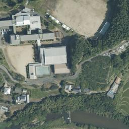
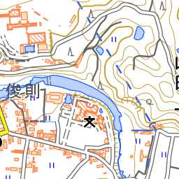
The interactive map needs JavaScript. Display anchor: 34.22027, 133.96836 (Point locator, WGS 84).
View location: OpenStreetMap · Google Maps · Bing aerial · Copernicus Browser
Campus reference; individual project footprints are not mapped.
Projects (1)
Highreso Ayagawa Existing Operations
Operational last observed as of · Authoritative status update
Municipal primary page names the former Ayakami Junior High School at Yamada-kami Ko 1180 and links its reuse document and site plan. Historical identity and property context only. evidence
Ayagawa Town · published 2023-09-26
Released with the September 26 municipal notice; cover identifies September 2023. Page 1 identifies the exact school/address; pages 6 and 7 show the campus layout and former bicycle parking beneath the gym. Historical layout only, not a current DC boundary. evidence
Ayagawa Town · published 2023-09-26
OpenStreetMap data licensing and attribution reference. evidence
OpenStreetMap Foundation · publication date not stated
Image captioned Ayagawa Town Data Center by the September 17 operator article shows the former gym and Highreso-branded entrance. Photograph acquisition time is unestablished; context only. evidence
Highreso · publication date not stated
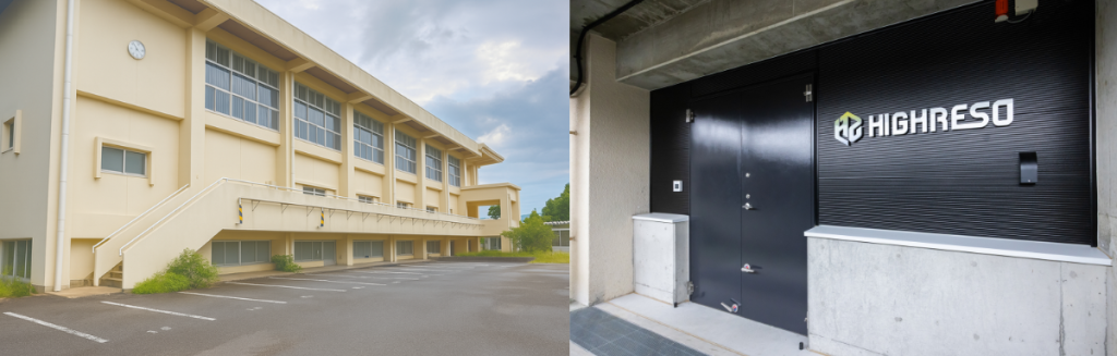
Government record distinguishes the former-school Ayagawa facility from Takamatsu within the foundation premises at Hayashi-cho; the approximately 687 square metres is facility floor area, not parcel area. evidence
Kagawa Prefectural Government · published 2026-02-24
Governor reports attending the named Highreso Ayagawa opening ceremony on March 3. Historical achieved opening context; exact operating start day unknown. This source does not establish September status. evidence
Kagawa Prefectural Government · published 2026-03-11
- Companies
- Operator: Highreso (current) evidence
Source and location review
- Status source
- Highreso Ayagawa operating facility and September visit evidence row
Highreso · published 2026-09-17 · Company disclosure - Locator
- Campus locator · Community mapped · named_former_school_parent_property_reference_point evidence
- Source checks
Not reviewed against imagery not_
reviewed
No imagery review is recorded for this project. Its status rests only on the dated authoritative source. · no independent imagery verificationStatus age at review: 40 days before the data update on 2026-10-27
Location details
- Coordinates
- 34.22027, 133.96836
- Geometry licence
- ODbL-1.0
- Use scope
- Campus locator
- Scope class
- named_former_school_parent_property_reference_point
- Authority
- Community mapped
- Source entity
- Campus
- Method
- osm_overpass_named_former_school_way_bounding_box_center
- Derivation
- direct_geometry
- Precision scope
- Reference point from the OpenStreetMap bounding box of the named former Ayakami Junior High School campus, used only as a parent-property locator. It is not an operator-published DC pin, surveyed centroid, official property boundary, data-center building location or under-gym footprint. Source coordinate digits do not establish ground accuracy.
- Horizontal uncertainty
Not reported
OSM feature geometry and its bounding-box reference point have no selected numeric positional-accuracy statement. Historical campus layout and source coordinate precision do not establish DC building accuracy.
- Geometry evidence
- fd4d0f64
A locator places the site on the map. It is not a building footprint, a construction extent or a surveyed boundary unless the use scope is an official boundary, and even then it is a parcel or permit boundary.
Evidence
Sources are linked, not redistributed; each keeps its own terms. An archived copy is a lookup for the Wayback Machine capture nearest the retrieval date and may be unavailable or differ from what was reviewed. Each hash states what it covers; imported factual records are not publisher-page captures.
| Title | Publisher | Roles | Published | Retrieved | Licence | Attribution | Content hash (SHA-256) |
|---|---|---|---|---|---|---|---|
| Ayagawa Town former Ayakami school reuse document and site plan Archived copy | Ayagawa Town Government notice | Site and project identity | all-rights-reserved | Ayagawa Town | d0ae3fb5ea84f74168ab4f532326f388ecc354ba55c9a678d5386be810aff019Retained source material; see source provenance | ||
| Ayagawa Town former Ayakami school reuse notice Archived copy | Ayagawa Town Government notice | Site and project identity | all-rights-reserved | Ayagawa Town | 6a911f5589b4f4acf81efedc13b81790b2dd837ac63b9ca37941a7a1648a39c1Retained source material; see source provenance | ||
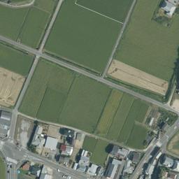
| GSI aerial reference tile 17/114311/52261 Archived copy | Geospatial Information Authority of Japan Map feature | Site and project identity | not stated | all-rights-reserved | Geospatial Information Authority of Japan | a0f907da6ad5f909d62342ad397a2da6fb405cc7eac6173fc1bba9236162a13dRetained source material; see source provenance | |
| GSI aerial reference tile 17/114311/52262 Archived copy | Geospatial Information Authority of Japan Map feature | Site and project identity | not stated | all-rights-reserved | Geospatial Information Authority of Japan | 0951cfc6d2af837da43b8a3bc04109162ea407f6e3f54e961708e501ab8a3e89Retained source material; see source provenance | |
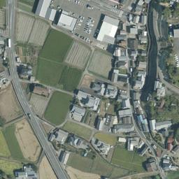
| GSI aerial reference tile 17/114312/52261 Archived copy | Geospatial Information Authority of Japan Map feature | Site and project identity | not stated | all-rights-reserved | Geospatial Information Authority of Japan | ede57b631bb84efd10f0764551dfecb96954727a35cd5e7670a7a6a809a07388Retained source material; see source provenance | |
| GSI aerial reference tile 17/114312/52262 Archived copy | Geospatial Information Authority of Japan Map feature | Site and project identity | not stated | all-rights-reserved | Geospatial Information Authority of Japan | a525bf8031a366f99f0abda2ee6eae9fd8af8f63998981a6d3fc8e63c5d1bd0cRetained source material; see source provenance | |
| GSI standard tile specification Archived copy | Geospatial Information Authority of Japan Map feature | Site and project identity | not stated | all-rights-reserved | Geospatial Information Authority of Japan | 1d9fa2729a17803aa3dc34ba0c5e144f183ce4f614885f3c44ac6802abe38aaaRetained source material; see source provenance | |
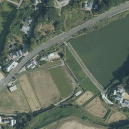
| GSI topographic reference tile 16/57156/26131 Archived copy | Geospatial Information Authority of Japan Map feature | Site and project identity | not stated | all-rights-reserved | Geospatial Information Authority of Japan | 4744b8640aa1ce19cde792165b39601860354be0b3511952c5f4ba2350d1cd2eRetained source material; see source provenance | |
| Highreso Ayagawa operating facility and September visit Archived copy | Highreso Company disclosure | Physical status, Operator claim | all-rights-reserved | Highreso | 3e909ae623bbadb0b758a5963711fd0dd6351f570360aca3939f30551d2bc35aRetained source material; see source provenance | ||
| Highreso labelled Ayagawa facility photograph Archived copy | Highreso Company disclosure | Site and project identity | not stated | all-rights-reserved | Highreso | 2f969f8e21a55954f3e317e8f93d0aedd77b7fef596170a1211f98771f1a95dbRetained source material; see source provenance | |
| Kagawa governor confirms attending Ayagawa data center opening ceremony Archived copy | Kagawa Prefectural Government Government notice | Site and project identity | all-rights-reserved | Kagawa Prefectural Government | 3fa857b4159d9b70ce7a899a20d5a92a4740d88b6d6fd7eb2cf3807c3ed207faRetained source material; see source provenance | ||
| Kagawa Prefecture distinguishes Takamatsu and Ayagawa facilities Archived copy | Kagawa Prefectural Government Government notice | Site and project identity | all-rights-reserved | Kagawa Prefectural Government | af1009bd09320d8990ad609073e5f7a0e8ecffcb196b5360ba2489cf59144ab9Retained source material; see source provenance | ||
| OpenStreetMap copyright and attribution terms Archived copy | OpenStreetMap Foundation Other | Site and project identity | not stated | ODbL-1.0 | © OpenStreetMap contributors | 3c21fce5b2b52ad5f1df08e7a8e65dbba40f56ca7091c32ce883ee7cc0608e24Retained source material; see source provenance | |
| OpenStreetMap former Ayakami school way and constituent nodes Archived copy | OpenStreetMap contributors OpenStreetMap | Site and project identity | not stated | ODbL-1.0 | © OpenStreetMap contributors | 0d6fcb2b366813d007f1044380fc2dfea1d82c3eced6c99e77b08fd05be16786Retained source material; see source provenance | |
| OpenStreetMap named former Ayakami school way bounding-box center Archived copy | OpenStreetMap contributors via Overpass API OpenStreetMap | Geometry | not stated | ODbL-1.0 | © OpenStreetMap contributors | da1e2bfc5449c09d7358a8f9ce939b3ea832b5955d071e05ca8b63eddf5d29d0Retained source material; see source provenance | |
| Overpass QL output geometry documentation Archived copy | OpenStreetMap Wiki contributors Map feature | Site and project identity | not stated | CC-BY-SA-2.0 | OpenStreetMap Wiki contributors | e3285516a3fd92d330b1bcc41f872d93c7896b91446cd32a404e8fefc277aa1eRetained source material; see source provenance |






Cite this site
Kyars, K. (2026). Highreso Ayagawa Town Data Center [site vcc-site-9489efce9491948dd2f9]. In Data Center Atlas (2026-10-27) [Data set]. https://kiankyars.github.io/datacenter-atlas/sites/vcc-site-9489efce9491948dd2f9/
Show on the map explorer JSON for this site GeoJSON for this site Download dataset Report a correction